The Wappinger Creek Cleanup Has a Map Now, and No Start Date
November 12, 2026
November 12, 2026
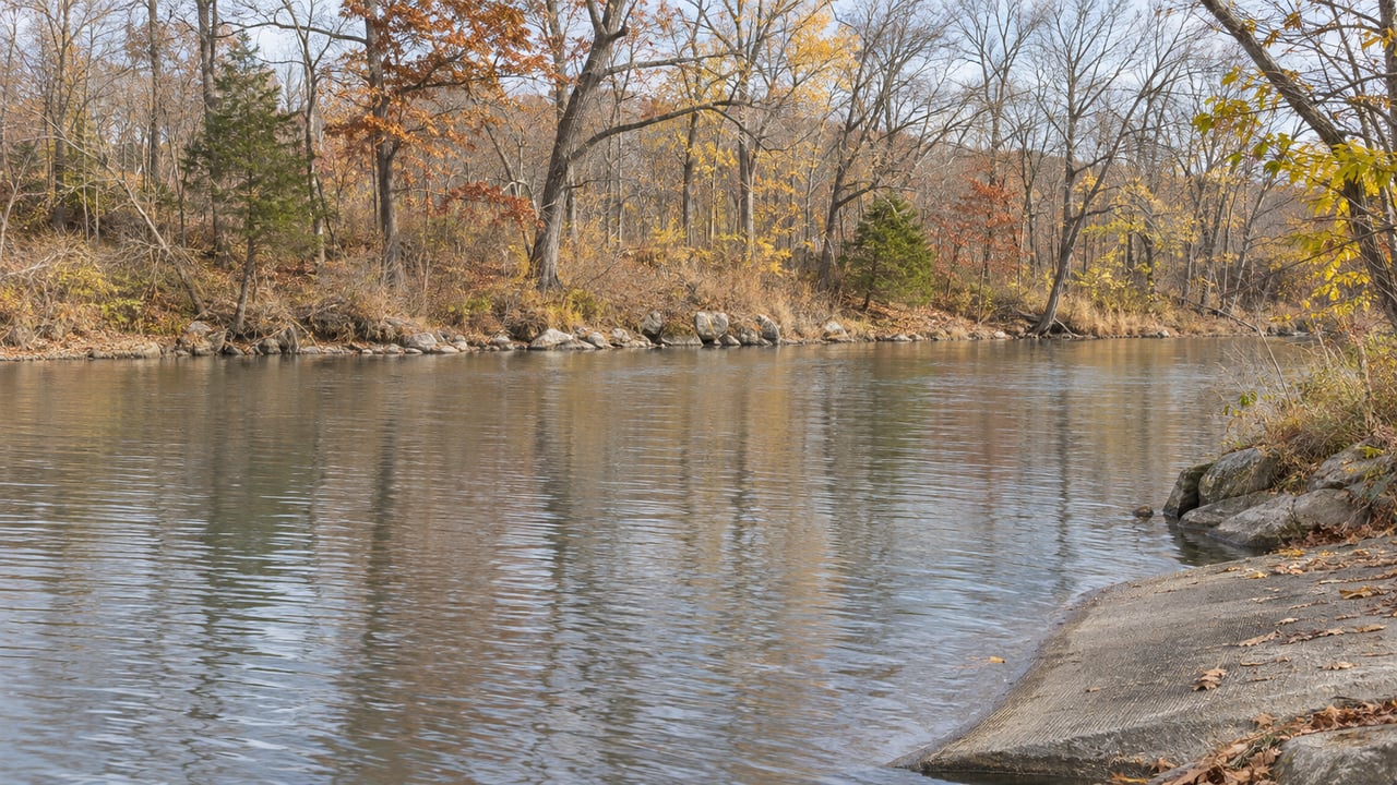
Below the falls, Wappinger Creek runs between stone retaining walls past the Market Street Industrial Park and under the steel bridge. It then widens toward the shoals and the embayment and reaches the Hudson about two miles downstream. Federal records treat that whole tidal stretch as one place, the Wappinger Creek Superfund site.
On September 28, 2026, the U.S. Environmental Protection Agency signed the decision on how to clean up the upper part of it. The EPA's site profile now calls the interim plan final and links to the 2026 Record of Decision. The decision draws a precise line around the work, and the creek's best-known public access point, the boat launch on County Road 91, falls inside it. It also leaves the calendar open, so the water below the falls this winter is the same water as last winter.
EPA divided the site into five sections, listed from upstream to downstream. The interim cleanup, which EPA calls Operable Unit One, covers the top three. It stops at what the agency calls the Hudson River Line, just south of the Embayment.
| Stretch | In this cleanup? | What the Record of Decision says is there |
|---|---|---|
| Industrial Park | Yes | The top of the site, beside the Market Street Industrial Park, with retaining walls on both shores and the steel bridge |
| Upper Shoal | Yes | The public boat launch on County Road 91 |
| Embayment | Yes | The site's main depositional area, sheltered from the current by the embayment peninsula |
| Lower Shoal | No, not in this interim action | Downstream of the embayment |
| Confluence | No, not in this interim action | Where Wappinger Creek meets the Hudson |
| Wappinger Lake | Outside the Superfund site | Above the hydroelectric dam upstream of the falls |
Several people asked during the comment period exactly where the work would happen relative to known access points. EPA answered in the Record of Decision itself. The County Road 91 launch is within the remedial area, and the steel bridge sits in the Industrial Park section. EPA also committed to installing signs and markers showing the site and remedial area before any construction begins.
Wappinger Lake is a separate case. The dam that controls the lake's level sits upstream of the falls and discharges directly into the site. EPA treats the lake as outside the site and unaffected by the historical industrial sources, and used it as a background sampling location.
The cleanup starts at the base of the falls because the contamination started there. EPA traces it to the Market Street Industrial Park, whose operations used the creek for stormwater drainage and for direct waste discharge from facilities and waste lagoons along the bank.
The Record of Decision lists the uses that left mercury in the sediment:
Watson Metals later occupied the facility until operations ceased in 1995. The Industrial Park has been active for more than 180 years and still houses several commercial businesses in its historic buildings. EPA states that nothing is being discharged to the creek today and that no new structures have been added there since industrial operations ended.
The site has been on the federal National Priorities List since September 9, 2016. That means a decade passed between listing and this signed plan.
EPA weighed four alternatives and chose Alternative 4. It dredges creek sediment and excavates streambank soil wherever total mercury exceeds 1.1 milligrams per kilogram, then backfills with clean material. It does not require a reactive cap. The estimated sediment dredging volume is 60,200 bank cubic yards.
The streambank work is much smaller. EPA's current estimate is about 1,900 bank cubic yards, dug to no more than half a foot deep, along roughly 10 percent of the bank length at a width of 50 feet. That is about one cubic yard of bank soil for every 32 of sediment. EPA says the exact boundaries will be set with more sampling during a pre-design investigation. The method for dredging and moving sediment on the water, such as barge-mounted excavators, will also be decided during design.
Removed material is to be treated and disposed of off site. Work areas are to be restored, and monitoring is required before, during and long after construction. The present-worth cost of the selected remedy is $88,098,000.
For the selected alternative, the Record of Decision estimates 19 months of construction spread over three years. It separately estimates three years to reach the cleanup's objectives. It gives no start date. That construction estimate also leaves out the steps that come first. The document says its timing excludes negotiating with responsible parties, designing the remedy, procuring contracts and later operation and maintenance.
The commitments in the Record of Decision fall in this order before anyone sees equipment on the water:
The signs are the visible marker. Until they go up along the creek, the stretch from the falls to the Embayment looks the way it always has.
The decision does not change how EPA describes everyday use of the creek. In its April 2025 community update, EPA said creek fish were contaminated mainly with methylmercury, PCBs, PAHs and arsenic. It also said boating, swimming and catch-and-release fishing may continue. It put the fish question plainly:
"People should not eat the fish in the creek."
New York's guidance takes a different form. The Record of Decision says the state Department of Health's Hudson River and Tributaries fish advisory covers the entire site. That advisory works by species and meal limits for the lower Hudson and has no separate entry for Wappinger Creek. The Times Union reported in June 2025 that the state had not issued a creek-specific advisory and that the lower creek fell under the Hudson River advisory. Anyone who fishes here can read both documents directly, and the selected remedy includes outreach on fish advisories.
Riverkeeper made the same distinction in a September 2026 WAMC report. The organization said it was "very satisfied" with EPA's choice. It also stressed that the contamination sits in the sediment and that the concern is people eating creek fish, not ordinary contact or paddling. Anglers WAMC interviewed generally welcomed the cleanup. One said he would be happy to see EPA clean the whole site, and some described people who still eat fish they catch there. Riverkeeper's public campaign asked EPA to warn anglers about eating the fish and to preserve public access and habitat in the final plan.
EPA released the proposed plan on July 23, 2026, and held a public meeting on July 30. It extended the comment period from August 21 to September 21 after a public request. The Poughkeepsie Journal covered the extension in mid-September. EPA signed the decision a week after the comment period closed.
The Record of Decision says comments generally supported the selected remedy. Support came from the Village of Wappingers Falls, the Towns of Wappinger and Poughkeepsie, Dutchess County entities, organizations and individuals. The record also includes residents' requests for more information and complaints that some learned of the public meeting only the day before. EPA offers a mailing list sign-up on the site profile for anyone who wants notices directly. The Record of Decision, with the remedial footprint maps in its Appendix I, is posted on New York State DEC's document site.
Debbie Allan has worked in Dutchess County since 1994 and keeps track of long-running projects like this one along Wappinger Creek. If you own a home near the lower creek and want to talk about how a multi-year federal cleanup fits into your plans, reach out to Debra Allan to request a free home valuation and a straightforward conversation about timing.
I am ready to work with you to help you sell or buy a home! So whether you are a first time buyer, relocation buyer, investor, moving up or downsizing...I am ready to roll up my sleeves to go to work for you! Make your next move with Debbie Allan!